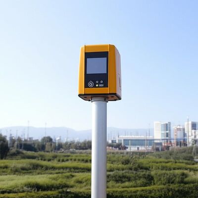
logo
होम उत्पादडॉपलर विंड लिडार

Vertical Range minus 10 to 190 degrees remote data collection tool featuring 4 kilometer vertical measuring distance tailored for industrial

प्रमाणन
चीन Nanjing Movelaser Co., Ltd. प्रमाणपत्र
ग्राहक समीक्षा
मैं बिक्री के बाद सेवा के दृष्टिकोण से बहुत संतुष्ट हूँ, उत्पाद की गुणवत्ता उत्कृष्ट है, और मैं इसे बनाए रखने के लिए जारी रखने के लिए उम्मीद है

—— लियोंग सियोंग

आपकी कंपनी के उत्पादों ने संचालन के दौरान उत्कृष्ट प्रदर्शन और उत्कृष्ट गुणवत्ता दिखाई है,प्रारंभिक परियोजना पवन माप और परिचालन परियोजना मूल्यांकन जैसे परिदृश्यों में मजबूत समर्थन प्रदान करना; आपकी टीम उपकरण की स्थापना, रखरखाव में समय पर प्रतिक्रिया, प्रभावी संचार और विचारशील सेवा प्रदान करती है।

—— युंडा ली

उत्पाद में समस्याएँ मिलने के बाद, बिक्री के बाद इसे जल्दी से निपटाया जा सकता है। उत्पाद को अधिक वातावरण के लिए उपयुक्त बनाने की अनुशंसा की जाती है。

—— जीमिन फू

कुल मिलाकर मैं बहुत संतुष्ट हूं और आशा करता हूं कि हमें और अधिक उन्नत, विश्वसनीय और स्थिर रडार उपकरण प्रदान करना जारी रखेगा।

—— फैन यांग

यह आशा की जाती है कि उत्पादों को अनुकूलित, अद्यतन और पुनरावृत्त करना जारी रहेगा, गुणवत्ता अधिक स्थिर होगी, और सेवा, वितरण और बिक्री के बाद उच्च गुणवत्ता बनाए रखेंगे, और उद्योग के अग्रणी स्तर को प्राप्त करेंगे।

—— युवेई वांगो

उत्पाद की डिलीवरी, उपकरण का प्रसंस्करण बहुत समय पर होता है

—— लांग चेन

विपणन कर्मियों का सकारात्मक रवैया, समय पर बिक्री के बाद सेवा

—— काई झाओ

कड़ी मेहनत करना जारी रखें, सहयोग जीतें

—— युयान ज़ी

उपकरण और सेवा बहुत अच्छी है, और मैं भविष्य में निरंतर सहयोग की आशा करता हूं।

—— मिंजी झोउ

उपकरण स्थापित करना आसान है और इकाई परीक्षण के लिए उपयुक्त है।

—— ल्यूक वांग

ग्राउंड-आधारित विंड लिडार का प्रदर्शन अच्छा है और हमारे आंतरिक और पूर्ण मशीन निर्माताओं द्वारा मान्यता प्राप्त है, और परीक्षण के परिणामों पर कोई आपत्ति नहीं है। बिक्री कर्मचारियों के पास व्यापक तकनीकी ज्ञान और पेशेवर उत्तर हैं। साइट पर कर्मचारी सक्रिय हैं और फिर से सहयोग करने के लिए तत्पर हैं।

—— कुनपेंग लु

रडार स्थापना सेवा में, विपणन कर्मियों के पास अच्छा रवैया, मजबूत तकनीकी क्षमता है, और समस्याओं को हल करते हैं, जो लिडार के परिवहन और स्थापना के लिए एक ठोस गारंटी प्रदान करता है।

—— लियांग गाओ

इस पवन मापन प्रणाली ने हमारे डेटा संग्रह को पूरी तरह से बदल दिया है। सटीकता और स्थिरता उत्कृष्ट हैं, यहां तक कि कठोर परिस्थितियों में भी। तकनीकी सहायता टीम असाधारण रूप से पेशेवर है!

—— जेम्स एम।

आपके LiDAR उपकरणों को तैनात करने के बाद से, हमारे पवन संयंत्र मूल्यांकन दक्षता में कम से कम 40% की वृद्धि हुई है। यह न केवल विश्वसनीय है बल्कि उपयोगकर्ता के अनुकूल भी है। क्षेत्र में किसी को भी अत्यधिक अनुशंसा की जाती है!

—— सोफिया चेन

उत्कृष्ट परिशुद्धता और अविश्वसनीय स्थायित्व! हमारे क्षेत्र स्टेशन इस उपकरण पर लंबे समय तक भरोसा करते रहे हैं, और इसने हमें कभी निराश नहीं किया है।अत्याधुनिक प्रौद्योगिकी और व्यावहारिक डिजाइन का एक उत्तम मिश्रण.

—— अहमद अल-फारसी

एक शोधकर्ता के रूप में, मैं उच्चतम डेटा सटीकता की मांग करता हूं। इस प्रणाली ने सभी अपेक्षाओं को पार कर लिया है, इसकी कम बिजली की खपत और आसान एकीकरण ने हमारी परियोजना को काफी तेज कर दिया है।

—— एलेना रॉसी

स्थिर, सटीक और लगभग रखरखाव मुक्त, यह बिल्कुल वही औद्योगिक स्तर का समाधान है जिसकी हमें आवश्यकता थी। इसने हमें परिचालन लागत में काफी कमी करते हुए ऊर्जा उत्पादन को अनुकूलित करने में मदद की है।

—— टॉमस हेरेरा

पूर्व-बिक्री परामर्श से लेकर तकनीकी प्रशिक्षण तक, सेवा अनुभव निर्दोष रहा है। उपकरण उत्कृष्ट प्रदर्शन करते हैं और हमारे ग्राहकों की पवन ऊर्जा परियोजनाओं के लिए महत्वपूर्ण अंतर्दृष्टि प्रदान करते हैं।

—— प्रिया शर्मा

हमने कई समान उत्पादों का परीक्षण किया है, लेकिन यह सिस्टम अपनी दीर्घकालिक स्थिरता और डेटा निरंतरता के लिए सबसे अलग है। यह वास्तव में पर्यावरणीय निगरानी में एक मौन भागीदार है।

—— ब्योर्न लंडग्रेन

मैं अब ऑनलाइन चैट कर रहा हूँ

Vertical Range minus 10 to 190 degrees remote data collection tool featuring 4 kilometer vertical measuring distance tailored for industrial

Vertical Range minus 10 to 190 degrees remote data collection tool featuring 4 kilometer vertical measuring distance tailored for industrial

बड़ी छवि :  Vertical Range minus 10 to 190 degrees remote data collection tool featuring 4 kilometer vertical measuring distance tailored for industrial

उत्पाद विवरण:
ब्रांड नाम: MOVELASER
Model Number: 3D Scanning Doppler Wind Lidar Molas 3D
भुगतान & नौवहन नियमों:
Minimum Order Quantity: 1 Set
Packaging Details: Air Box
Delivery Time: 1-2 Months
Payment Terms: L/C, D/A, D/P, T/T
Supply Ability: 200 Set ,1 Month
विस्तृत उत्पाद विवरण
Size: 756mm*735mm*1000mm Sight Detection Distance: 10km
Maximum Acquisition Distance: 15km Distance Resolution: 15m/30m/75m/120m
Sight Wind Speed Accuracy: 0.1m/s Weight: ≤100kg
Pointing Acuracy: ±0.005° DataStorage Time: 5to18months
प्रमुखता देना:

Doppler Wind Lidar remote data collection

,

Doppler Wind Lidar 4km measuring distance

,

Doppler Wind Lidar industrial vertical range

Product Description:

Molas 3D is an advanced Doppler wind measurement lidar that operates using three-dimensional scanning technology. It utilizes the principle of pulsed laser coherent Doppler frequency shift to accurately capture wind speed data.

This innovative device supports multiple scanning modes, including P-Pl, RHI, DBS, and program scanning. Such versatility allows it to be tailored for specific wind speed measurement requirements across various applications.

The Molas 3D lidar is well-suited for a wide range of customized scenarios. These include offshore wind resource assessment, research in complex terrains, wind turbine wake detection, and airport glide path wind shear warnings. Additionally, it is valuable for urban meteorological observations and detecting high-altitude turbulence.


Features:

Comprehensive Measurement Capabilities

The system offers detailed measurement information by utilizing a refined 3D wind field measurement technique. It supports up to 300 customizable distance layers, allowing for precise and tailored data acquisition.

Wide Detection Range

Equipped with a large detection range, the device can monitor sight distances up to 10 kilometers, particularly effective at altitudes below 600 meters.

High Accuracy Performance

This technology ensures exceptional precision, featuring a pointing accuracy of 0.005 degrees and a visual direction wind speed accuracy of 0.1 meters per second.

Diverse Scanning Methods

Multiple scanning techniques are supported, including PPl, RHl, DBS, and a programmable arbitrary scan method, allowing for versatile operational modes based on varying measurement needs.

Flexible and Lightweight Deployment

Designed to be small and lightweight, the system facilitates easy transportation and rapid deployment in different environments.

All-Weather Durability

Built to withstand harsh outdoor environments, it offers survivability in LPz0 and features lightning protection zones, ensuring reliable operation regardless of weather conditions.

Safety and Security Features

Safety is paramount, with integrated GPS location reporting and geo-fencing capabilities. Additionally, data encryption safeguards against any risk of information leakage.

Multiple Configuration Options

Users can select from four distance resolutions and five accumulation times, providing flexibility to tailor the system’s operation to specific requirements.


Technical Parameters:

Vertical Range -10~190°
Sight Detection Distance 10 km
Sight Wind Speed Range -75~+75 m/s
Distance Resolution 15 m / 30 m / 75 m / 120 m
Sight Wind Speed Accuracy 0.1 m/s
Distance Layers Up to 300
Pointing Accuracy ±0.005°
Accumulation Time 0.2~10 s (Optional)
Data Storage Time 5 to 18 months
Vertical Measuring Distance 4 km

Applications:

Wind resource assessment involves collecting wind field data over extensive areas, which helps to minimize the risks associated with site selection for wind energy projects. By accurately measuring wind parameters, it ensures better planning and utilization of wind resources.

Long-distance power curve measurements and wake eddy current assessments play a significant role in optimizing wind energy utilization. These measurements contribute to improving the efficiency of wind energy units by providing detailed insights into wind flow dynamics and turbine performance.

Early detection and warning systems are essential for identifying dangerous meteorological phenomena, such as wind shear and microbursts. Timely warnings can enhance safety measures in aviation and other weather-sensitive operations.

Measuring wake vortices is crucial for optimizing flight separation at airports. By understanding these vortices, air traffic controllers can better manage aircraft spacing, thereby increasing airport traffic efficiency and safety.

Providing detailed wind field information aids in understanding the behavior of wind within the atmospheric boundary layer. This data is vital for meteorological studies and improving weather forecasting models.

Accurate and high spatiotemporal wind profile measurements near the surface, within a few kilometers, help fill the observation gaps at low altitudes. This enhanced data resolution supports various applications ranging from environmental monitoring to renewable energy development.

Real-time three-dimensional information about plume dispersion enables effective tracking of emission sources. Such monitoring is particularly valuable for environmental management and controlling air pollution.

Additionally, optimizing dust emission control in the mining industry relies on precise wind and dispersion measurements. These techniques help minimize environmental impacts and enhance operational safety in mining activities.


सम्पर्क करने का विवरण
Nanjing Movelaser Co., Ltd.

व्यक्ति से संपर्क करें: Miss. ivyyao

दूरभाष: +86 13072523225

फैक्स: 86-025-86800073

हम करने के लिए सीधे अपनी जांच भेजें (0 / 3000)

अन्य उत्पादों